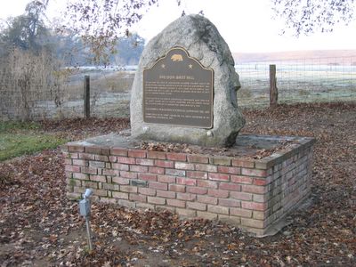
California State Historical Landmark #439
See this location on Yahoo Maps in Flickr
See this location on Google Maps
This landmark is located at the intersection of Meiss Road and Highway 16, 100 feet west of Sloughhouse. There are 57 other California State Historical Landmarks in Sacramento County. The GPS coordinates for this location are N 38° 29.792 W 121° 11.840.
You can log your visit to this landmark at waymark.com.


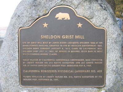
Site of Grist Mill built by Jared Dixon (Joaquin) Sheldon 1846-47 on Omochumnes Rancho, granted to him by the Mexican government 1843. Sheldon born in Vermont January 8, 1813, came to California in 1832. Sheldon shot July 11, 1851, by miners in quarrel over dam he built which flooded miners' claims.
It looks like this marker has been moved some time in the last ten years. Some sources and a sign on Highway 16 suggest that the marker is about a one mile south east on Meiss Road near the Consumes River. About two months ago, I drove to the end of Meiss Road looking for the marker; it is a very peaceful, secluded spot that seems a lot farther from Sacramento than it is.
No comments:
Post a Comment