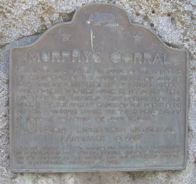
California State Historical Landmark #680
See this location on Yahoo Maps in Flickr
See this location on Google Maps
This landmark is located near the southwest corner of Grant Line Road and Highway 99, Elk Grove, California. There are 57 other California State Historical Landmarks in Sacramento County. The GPS coordinates for this location are N 38° 22.477 W 121° 21.711.
You can log your visit to this landmark at waymark.com.


This is the site of the beginning of the conquest of California by the United States. On June 10, 1846, American settlers led by Ezekial Merritt overpowered soldiers under Lt. Francisco Arce and took their Mexican army horses from the corral of the Murphy Ranch on the north bank of the Consumnes River. The "Bear Flag" action in Sonoma followed on June 14, 1846.
The actual site of Murphy’s Corral is located several miles south of the historical marker.
No comments:
Post a Comment